
County and North Carolina Department of Transportation officials continue to urge residents to stay off roadways, and avoid travel, unless there is an absolute necessity to do so.
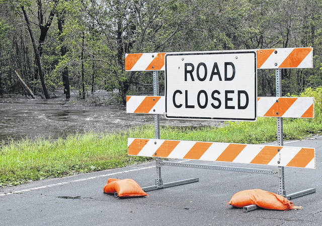
As of 11 a.m., Sampson County’s Emergency Management Service reported 69 washed out roads or bridges in the county, 14 road closures, 153 incidents of high water on roads and 126 reports of trees blocking roads.
NC DOT is advising motorists not to travel in the southern, central and eastern part of North Carolina due to the extensive flooding in the area. A total of 1,226 roads across the state have been impacted during this storm.
The following roads are listed on the North Carolina Department of Transportation’s website as being closed. This list is updated frequently, so there may be changes from information listed. Some roads listed have multiple closings.
• Turkey Hwy (NC-24) East of Clinton, both directions
• S Salemburg Hwy (NC-242) North of Roseboro, both directions
• Elizabethtown Hwy (NC-242) South of Roseboro, both directions
• Faison Hwy (NC-403) North East of Clinton, both directions
• Faison Hwy (NC-403) North East of Clinton, both directions
• Wallace Hwy (NC-41) East of Harrells, both directions
• Harrells Hwy (NC-411) West of Harrells, both directions
• E Magnolia-Lisbon Road (NC-903) North East of Harrells, both directions
• W Magnolia-Lisbon Road (NC-903) West of Harrells, both directions
• Edmond Matthis Road (SR-1004) South of Clinton, both directions
• Green Path Road (SR-1005) North of Plain View, both directions
• Hoover Road (SR-1106) South of Harrells, both directions
• Pearson Road (SR-1116) South of Clinton, both directions
• Lundy Road (SR-1130) North of Garland, both directions
• Lundy Road (SR-1130) North West of Harrells, both directions
• Boney Mill Road (SR-1145) South of Clinton; mile marker 1.9 to 2.6, both directions
• W. Mount Gilead Church Road (SR-1147) Near Clinton, both directions
• Ebenezer Forest Road (SR-1211) North West of Ingold , both directions
• Boykin Bridge Road (SR-1214) South West of Clinton, both directions
• Boykin Bridge Road (SR-1214) Near Roseboro, both directions
• Andrews Chapel Road (SR-1216) South East of Roseboro, both directions
• Peterson Road (SR-1219) South of Clinton, both directions
• Beulah Road (SR-1222) South West of Clinton, both directions
• Autryville Road (SR-1233) West of Salemburg, both directions
• Bonnetsville Road (SR-1233) In Salemburg, both directions
• Fleet Cooper Road (SR-1240) South East of Roseboro, both directions
• Butler Island Road (SR-1246) South West of Roseboro, both directions
• Five Bridge Road (SR-1311) North West of Clinton, both directions
• Zoar Church Road (SR-1322) North of Salemburg, both directions
• Old Salemburg Road (SR-1409) In Salemburg, both directions
• Minnie Hall Road (SR-1414) North West of Salemburg, both directions
• Autry Mill Road (SR-1446) North of Roseboro, both directions
• Aman Dairy Road (SR-1605) West of Spiveys Corner, both directions
• Ira B Tart Road (SR-1621) North West of Newton Grove, both directions
• Roanoke Road (SR-1636) South East of Spiveys Corner, both directions
• Church Road (SR-1703) North of Clinton, both directions
• Church Road (SR-1703) South West of Newton Grove, both directions
• Kornegay Town Road (SR-1706) South East of Newton Grove, both directions
• William R King Road (SR-1711) South East of Newton Grove, both directions
• Giddensville Road (SR-1725) North East of Keener, both directions
• E Darden Road (SR-1740) East of Keener, both directions
• Bryan Road (SR-1800) South of Newton Grove, both directions
• Beaman Street (SR-1838) In Clinton; mile marker 1 to 1.0, both directions
• Pine Ridge Road (SR-1904) North East of Clinton, both directions
• Mcgowan Road (SR-1905) North East of Autryville, both directions
• Thompson Avenue (SR-1906) North East of Clinton, both directions
• Old Warsaw Road (SR-1919) North East of Clinton, both directions
• Rowan Road (SR-1924) East of Clinton, both directions
• Beulah Church Road (SR-1952) North East of Clinton, both directions
• Fayetteville Hwy. (US-13) West of Spivey’s Corner, both directions
• Newton Grove Hwy (US-13) South West of Newton Grove, both directions
• Taylors Bridge Hwy. (US-421) South of Clinton, both directions
• Wilmington Hwy (US-421) South East of Harrells, both directions
• Garland Hwy (US-701) North of Garland, both directions
• Garland Hwy (US-701) South of Clinton, both directions
Additional roads throughout the county are blocked/impassable due to downed trees and high water. According to county officials, when reports are being made in regard to downed trees, available resources are dispatched to assess and remove when possible.